El Niño rains: 10 Nairobi roads with a history of flooding
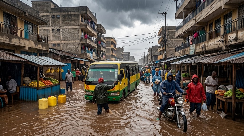
By Steve Ireri, September 3, 2026For years, heavy rains have turned some of Nairobi’s busiest roads into dangerous stretches of water, leaving motorists stranded and commuters scrambling for alternative routes.
With an intensifying El Niño expected during the October-to-December short-rains season, those notorious flood points are once again under scrutiny.
The Kenya Meteorological Department has warned of above-normal rainfall across more than 40 counties, raising fresh concerns over the capital’s ability to cope with another spell of intense downpours.
Here are 10 Nairobi roads with a history of flooding that motorists may need to approach with extra caution when the rains arrive.
1. Uhuru Highway
Uhuru Highway, one of the principal arteries through Nairobi’s Central Business District, has repeatedly struggled to cope with torrential rainfall.
The road sits at the receiving end of runoff from heavily built-up sections of the city, where concrete surfaces leave little room for rainwater to soak into the ground.
Runoff cascaded from the surrounding concrete surfaces towards the highway, overwhelming stormwater channels and leaving sections of the road completely impassable.
Dozens of cars and matatus were submerged, with some motorists forced to abandon their vehicles after becoming trapped in the rising waters.
The episode offered a stark reminder of how quickly one of Nairobi’s busiest roads can become paralysed when drainage systems are overwhelmed.
2. Mombasa Road
Mombasa Road is another critical corridor that becomes highly vulnerable when heavy rains descend on the capital.
The road is particularly important because it connects Nairobi with Jomo Kenyatta International Airport, meaning flooding along the corridor can have consequences far beyond ordinary traffic delays.
Major flooding was reported on March 7 and again between April 30 and May 1, 2026.
A lorry became submerged in the rising water, further obstructing the road and worsening the situation.
Traffic backed up for several kilometres between Ole Sereni and the Standard Group offices, leaving thousands of commuters stranded.
The flooding became so disruptive that the elevated section of the Nairobi Expressway was temporarily opened to provide emergency access, particularly for motorists heading towards the airport.
3. Bunyala Road
Bunyala Road, located within the low-lying Industrial Area perimeter, has emerged as one of Nairobi’s most dangerous flash-flooding points.
The road lies within the Ngong River drainage basin, making it particularly vulnerable when sustained rainfall causes water levels to rise rapidly.
The danger became evident near midnight on March 14, 2026, when the Ngong River overflowed following heavy rainfall upstream.
The resulting floodwaters swept across the Bunyala Road corridor, catching commuters in their vehicles.
The Kenya Red Cross Aqua Rescue Team was deployed to the area and rescued 11 commuters who had become trapped inside a matatu as water rapidly filled the vehicle.
The force of the water was also strong enough to damage road guards along the affected stretch.
Bunyala Road therefore remains one of the corridors where motorists face a particularly dangerous combination of deep water and fast-moving currents.
4. Lusaka Road
Lusaka Road cuts through the heart of Nairobi’s Industrial Area, where extensive concrete surfaces leave limited room for rainwater to naturally drain away.
The road was severely affected by flooding late on March 14, 2026, during the same period when Bunyala Road was overwhelmed.
Heavy rainfall caused water to back up through the Industrial Area’s drainage network, with blocked and overwhelmed channels unable to cope with the volume.
Large sections of the road were transformed into a standing lake of contaminated water mixed with industrial runoff.
Freight trucks and vehicles serving factories were forced to stop operations as the water covered the road, with some activities only resuming after the waters receded on the morning of March 15.
The flooding highlighted the vulnerability of one of Nairobi’s most important industrial corridors to drainage failures during intense rainfall.
5. Lang’ata Road
Lang’ata Road has endured years of waterlogging, with some of its most vulnerable sections located around the T-Mall junction and Nairobi West.
The road crosses sections of the Ngong River drainage network, meaning an overwhelmed river system can quickly send water towards the road.
Flooding was recorded on March 7 and again on May 1, 2026.
At the T-Mall junction, storm drains were overwhelmed by rapidly rising water, turning the depression around the road into a dangerous flood point.
During the May 1 incident, a vehicle lost control in conditions of poor visibility and ended up in a deeply submerged roadside ditch.
Emergency responders from the Kenya Red Cross intervened to extract the occupants as water continued to flow around the vehicle.
For motorists, the danger on Lang’ata Road is therefore not only traffic disruption but also the difficulty of judging the depth of submerged sections and roadside hazards.
6. Ngong Road
Despite extensive upgrades and the expansion of Ngong Road into a modern dual carriageway, some sections continue to struggle during heavy rainfall.
The Ngando and Dagoretti areas are particularly vulnerable because local drainage systems can become overwhelmed during intense storms.
On the evening of March 14, 2026, heavy rainfall triggered flash flooding in the densely populated neighbourhoods around Ngando.
Open drainage trenches became overwhelmed, while silt and debris mixed with the floodwater and blocked sections of the road.
Motorists heading towards Karen were forced to turn back or risk driving through deep pools of water that could stall their vehicles.
The flooding demonstrated that even modern road upgrades cannot completely eliminate flood risks when surrounding drainage networks remain inadequate.
7. Outer Ring Road and Jogoo Road intersection
The Outer Ring Road-Jogoo Road intersection serves one of Nairobi’s most densely populated transport corridors and can quickly become a major bottleneck during heavy rains.
The problem was starkly exposed on the morning of March 7, 2026, when huge volumes of stormwater overwhelmed drainage systems around the intersection.
Runoff from densely populated areas, combined with blocked drainage channels, sent water towards the road.
Solid waste, particularly plastic waste from nearby markets and residential areas, further obstructed underground culverts and drainage gullies.
The rising water cut off movement through parts of Eastlands, leaving thousands of commuters stranded.
Some were forced to abandon public transport and wade through waist-high water as they attempted to find alternative ways into the Central Business District.
The intersection’s flooding problem therefore carries consequences for an enormous population that relies on the corridor every day.
8. Thika Superhighway
Thika Superhighway may have been constructed to modern standards, but several low-lying sections and underpasses remain vulnerable to water accumulation.
The problem became apparent on March 7, 2026, when heavy rainfall sent large volumes of runoff from surrounding high-density residential developments towards sections of the highway between Githurai and Kahawa Sukari.
Deep pools formed in low-lying areas, forcing motorists to slow down considerably on what is otherwise a high-speed corridor.
Silt washed down from construction projects and nearby developments can also accumulate in culverts, reducing their ability to carry away stormwater.
For motorists, the combination of high speeds and suddenly appearing pools of standing water creates an added safety risk.
9. Enterprise Road
Enterprise Road is another important Industrial Area corridor that repeatedly comes under pressure during heavy rainfall.
Its vulnerability is closely tied to the highly built-up nature of the surrounding area.
With vast areas covered by concrete and asphalt, rainwater has little opportunity to infiltrate the ground and instead becomes surface runoff that quickly enters the drainage system.
On March 7, 2026, heavy rainfall overwhelmed the road’s stormwater network.
Silt and plastic waste had choked sections of the drainage system, leaving large parts of the road waterlogged.
The flooding disrupted freight movement and affected businesses operating within the surrounding commercial and industrial blocks.
For a road that carries vehicles serving Nairobi’s manufacturing and logistics sector, such flooding can therefore quickly translate into wider economic disruption.
10. Limuru Road near Museum Hill
The Museum Hill section of Limuru Road is vulnerable because of its position at a natural low point that receives runoff from higher ground.
During heavy rainfall, water flowing down from the Parklands and Westlands areas gathers around the lower sections of the road.
The vulnerability was exposed on the night of March 14, 2026, when large volumes of water rushed towards the Museum Hill underpass.
The location’s topography means that even when rain falls elsewhere, runoff from higher ground can converge rapidly at the low-lying section.